National Weather Service Issues June 22, 2017 Hazardous Weather Outlook for Tri-State Area
The National Weather Service in Paducah, KY, is anticipating some nasty weather the rest of this week with a slight possibility of tornadoes. Download our new app to keep you up-to-date on all weather info!
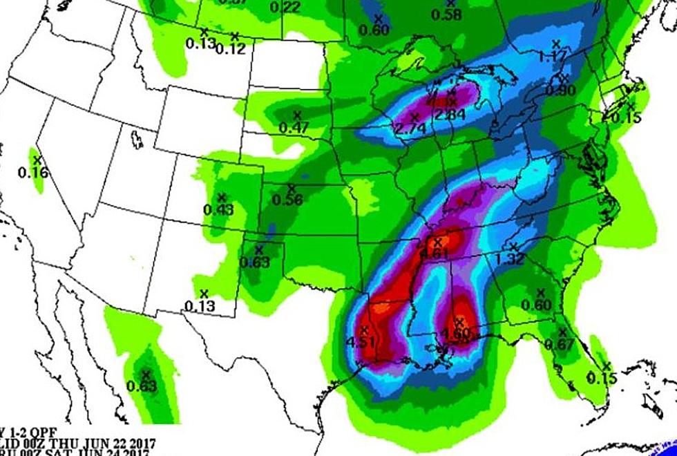
This Hazardous Weather Outlook is for portions of southern Illinois, southwest Indiana, western Kentucky, and southeast Missouri.
DAY ONE...Today and Tonight
Thunderstorms are possible with increasing rain chances later today and tonight. Heavy rainfall will be the primary storm related hazard through the period. Any strong storm chances include a marginal risk of severe storms, with an isolated weak tornado a possibility mainly this afternoon or evening, during the maximum heating and instability time.
DAYS TWO THROUGH SEVEN...Friday through Wednesday
The most potent chance for heavy rain comes with showers and storms Friday afternoon and early evening. The moisture from Tropical Storm Cindy will combine with an approaching cold front to peak this heavy rain chance and the potential for flooding. Storm total rainfall amounts should average from 2 to 4 inches across western Kentucky, with 1 to 3 inches to the north and west. Locally higher amounts are possible with persistent or repeat thunderstorms. The marginal risk of a storm becoming severe includes as the primary hazard isolated weak tornadoes.
Detailed Forecast
More From WBKR-FM


![Dazzling, Frightening ‘River Tornado’ Straddles the Ohio Between KY & IN [VIDEO]](http://townsquare.media/site/76/files/2024/03/attachment-Untitled-design-2024-03-15T173728.814.jpg?w=980&q=75)


