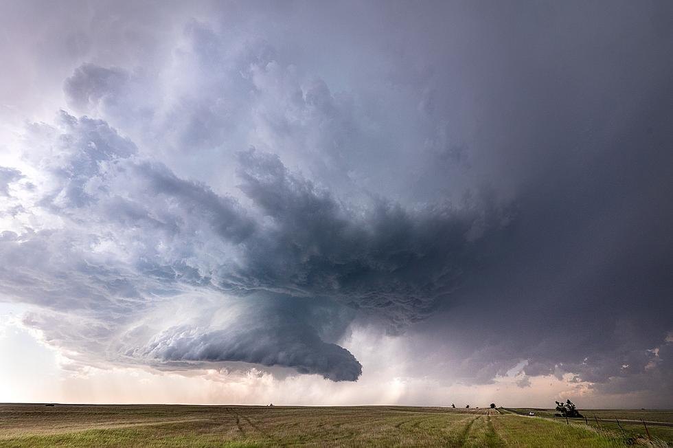
Tornadoes are a real possibility Friday night. Most of the tri-state is under a level 3 ENHANCED risk. Union County, Kentucky and points west are under a MODERATE risk.
Western Kentucky and southern Indiana are under a level three ENHANCED risk for severe weather, including the potential for tornadoes, late Friday night.
The tornado that tore through Stanley in rural Daviess County on Saturday left quite a path of destruction behind. Chris Conley and Mean Motion Media has captured the storm's aftermath.
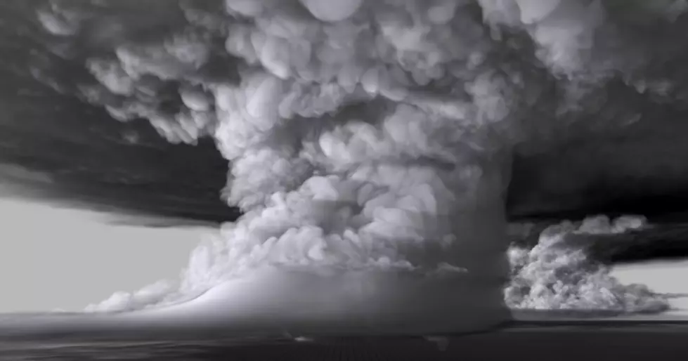
It's been one wild weather season here in the Tri-State with every imaginable scenario possible, except for the strongest type of tornado, an EF-5. Leigh Orf, a scientist with Cooperative Institute for Meteorological Satellite Studies at the University of Wisconsin at Madison re-created an EF-5 tornado that touched down during an outbreak in Oklahoma in 2011. This is amazing.
Growing up, I just thought tornadoes were only supposed to happen in the spring. After all, the deadly Brandenburg tornado of 1974 was a spring storm, and that is THE reference point storm for the 1970s.
For the second straight day, the tristate is under a severe weather threat and tornadoes are a strong possibility in portions of the WBKR listening area. Over the weekend, CNN, knowing that the Midwest was facing multiple days of a serious tornado outbreak, published a really cool video about twisters. Here are 10 Tornado Facts That Will Blow Your Mind.
Ya'll know I am huge fan of severe weather. And I am particularly fascinated by it when it shows up in unexpected and extreme places. 34 separate tornadoes wreaked havoc in the Gulf on Christmas Day and lots of footage of those storms is surfacing online. But, for me, some of the coolest footage from the holiday's weather breakout came from some folks who were crossing the never-ending Lake Pon
Forecasters knew, days in advance, that Saturday, April 14th was shaping up to be a treacherous day for tornado outbreaks in the Plains. Many areas in Oklahoma and Kansas were placed under a HIGH risk for severe weather and residents were warned of a potentially life-threatening weather situation. And, as predicted, Mother Nature delivered. Twisters were everywhere! But, outside Cherokee, Okla
Hate to be the bearer of bad news, tornadoes are expected to be above normal for 2012 going to pray and hope that isn't the case. In 2011 there was a report of 1,709 tornadoes in the U.S. close to the record of 1,817 set in 2004. 2011 is ranked as the 4th most deadly tornado season ever recorded in the United States.
The National Weather Service says there's a possibility of Severe Weather late t
The last few days have been very windy and a little warmer each day, today we are expecting those windy conditions to continue with High's in the 70's. This afternoon and evening we have a slight risk for severe weather. WBKR and News25 will be on the air live with weather coverage if severe weather does break out...
I don’t remember very many really bad storms as a child. We’d have tornado warnings and the sirens would sound. That would frighten the life out of me, but then we’d head over to my grandmother’s house and go down into her basement and then nothing would materialize. And when I was kid, I LOVED snowstorms. But I’m all grown up now. And I have grown-up attitudes about some of these nasty storms. In


![10 Tornado Facts [Video]](http://townsquare.media/site/76/files/2014/04/hqdefault6.jpg?w=980&q=75)
![Footage of Christmas Day Water Spout on Lake Ponchartrain [Video]](http://townsquare.media/site/76/files/2012/12/hqdefault20.jpg?w=980&q=75)
![Oklahoma Wall Cloud Spawns Two Tornadoes [Video]](http://townsquare.media/site/76/files/2012/04/hqdefault15.jpg?w=980&q=75)


