Tri-State Severe Weather: Watches and Warnings
Tornado Warning issued May 26 at 10:09PM EDT until May 26 at 10:30PM EDT by NWS Paducah KY
At 1009 PM EDT, a severe squall line capable of producing both
tornadoes and extensive straight line wind damage was located along a
line extending from near Petersburg to near Winslow, moving east at
60 mph.
HAZARD...Tornado.
SOURCE...Radar indicated rotation.
IMPACT...Flying debris will be dangerous to those caught without
shelter. Mobile homes will be damaged or destroyed. Damage
to roofs, windows, and vehicles will occur. Tree damage is
likely.
These tornadic storms will remain over mainly rural areas of eastern
Pike County.
This includes Interstate 69 in Indiana between Mile Markers 43 and
52.
Instructions
TAKE COVER NOW! Move to a basement or an interior room on the lowest
floor of a sturdy building. Avoid windows. If you are outdoors, in a
mobile home, or in a vehicle, move to the closest substantial shelter
and protect yourself from flying debris.
_____________________________________________________________________
The National Weather Service in Paducah has issued a
* Tornado Warning for...
Northeastern Gibson County in southwestern Indiana...
Pike County in southwestern Indiana...
* Until 930 PM CDT/1030 PM EDT/.
* At 855 PM CDT/955 PM EDT/, severe thunderstorms capable of
producing both tornadoes and extensive straight line wind damage
were located along a line extending from 8 miles west of Petersburg
to near Princeton, moving east at 55 mph.
HAZARD...Tornado.
SOURCE...Radar indicated rotation.
IMPACT...Flying debris will be dangerous to those caught without
shelter. Mobile homes will be damaged or destroyed.
Damage to roofs, windows, and vehicles will occur. Tree
damage is likely.
* These dangerous storms will be near...
Oakland City around 900 PM CDT.
Petersburg around 1000 PM EDT.
Winslow around 1005 PM EDT.
Other locations impacted by these tornadic storms include Francisco.
This includes Interstate 69 in Indiana between Mile Markers 31 and
52.
Instructions
TAKE COVER NOW! Move to a basement or an interior room on the lowest
floor of a sturdy building. Avoid windows. If you are outdoors, in a
mobile home, or in a vehicle, move to the closest substantial shelter
and protect yourself from flying debris.
_____________________________________________________________________
Tornado Warning issued May 26 at 8:49PM CDT until May 26 at 9:00PM CDT by NWS Paducah KY
At 848 PM CDT, a severe squall line capable of producing both
tornadoes and extensive straight line wind damage was located over
Owensville, or near Fort Branch, moving east at 60 mph.
HAZARD...Tornado.
SOURCE...Radar indicated rotation.
IMPACT...Flying debris will be dangerous to those caught without
shelter. Mobile homes will be damaged or destroyed. Damage
to roofs, windows, and vehicles will occur. Tree damage is
likely.
These dangerous storms will be near...
Fort Branch and Haubstadt around 855 PM CDT.
Other locations impacted by this tornadic thunderstorm include
Elberfeld, Somerville, and Mackey.
This includes the following highways...
Interstate 69 in Indiana between Mile Markers 18 and 31.
Interstate 64 in Indiana between Mile Markers 18 and 38.
Instructions
TAKE COVER NOW! Move to a basement or an interior room on the lowest
floor of a sturdy building. Avoid windows. If you are outdoors, in a
mobile home, or in a vehicle, move to the closest substantial shelter
and protect yourself from flying debris.
_____________________________________________________________________
The National Weather Service in Paducah has issued a
* Tornado Warning for...
Northwestern Warrick County in southwestern Indiana...
Northern Vanderburgh County in southwestern Indiana...
Southern Gibson County in southwestern Indiana...
Northeastern Posey County in southwestern Indiana...
* Until 900 PM CDT.
* At 834 PM CDT, severe thunderstorms capable of producing both
tornadoes and extensive straight line wind damage were located near
Poseyville, or 14 miles southeast of Albion, moving east at 60 mph.
HAZARD...Tornado.
SOURCE...Radar indicated rotation.
IMPACT...Flying debris will be dangerous to those caught without
shelter. Mobile homes will be damaged or destroyed.
Damage to roofs, windows, and vehicles will occur. Tree
damage is likely.
* These dangerous storms will be near...
Owensville, Poseyville, and Cynthiana around 840 PM CDT.
Fort Branch and Haubstadt around 845 PM CDT.
Other locations impacted by this tornadic thunderstorm include
Griffin, Mackey, Elberfeld, and Somerville.
This includes the following highways...
Interstate 69 in Indiana between Mile Markers 18 and 31.
Interstate 64 in Indiana between Mile Markers 2 and 38.
Instructions
TAKE COVER NOW! Move to a basement or an interior room on the lowest
floor of a sturdy building. Avoid windows. If you are outdoors, in a
mobile home, or in a vehicle, move to the closest substantial shelter
and protect yourself from flying debris.
_____________________________________________________________________
The National Weather Service in Paducah has issued a
* Tornado Warning for...
Northeastern Caldwell County in western Kentucky...
Southern Hopkins County in northwestern Kentucky...
* Until 915 PM CDT.
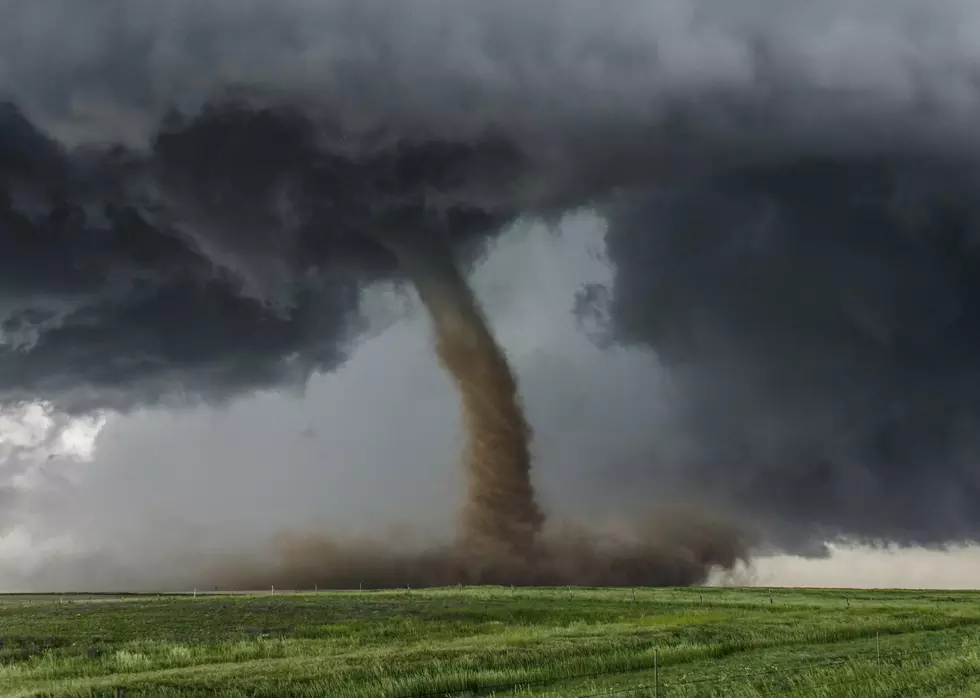
* At 824 PM CDT, a confirmed large and extremely dangerous tornado
was located just south of Farmersville, or near Princeton, moving
east at 30 mph.
This is a PARTICULARLY DANGEROUS SITUATION. TAKE COVER NOW!
HAZARD...Damaging tornado.
SOURCE...Weather spotters confirmed tornado.
IMPACT...You are in a life-threatening situation. Flying debris
may be deadly to those caught without shelter. Mobile
homes will be destroyed. Considerable damage to homes,
businesses, and vehicles is likely and complete
destruction is possible.
* The tornado will be near...
Dawson Springs and Olney around 830 PM CDT.
Madisonville, Earlington, and Mortons Gap around 855 PM CDT.
Nortonville around 900 PM CDT.
Other locations impacted by this tornadic thunderstorm include St.
Charles, Fryer, and White Plains.
This includes the following highways...
Interstate 69 in Kentucky between Mile Markers 85 and 118.
Western Kentucky Parkway between Mile Markers 39 and 43.
Pennyrile Parkway between Mile Markers 30 and 34.
Instructions
To repeat, a large, extremely dangerous and potentially deadly
tornado is on the ground. To protect your life, TAKE COVER NOW! Move
to a basement or an interior room on the lowest floor of a sturdy
building. Avoid windows. If you are outdoors, in a mobile home, or in
a vehicle, move to the closest substantial shelter and protect
yourself from flying debris.
_____________________________________________________________________
The National Weather Service in Paducah has issued a
* Tornado Warning for...
Wabash County in southeastern Illinois...
Edwards County in southeastern Illinois...
Gibson County in southwestern Indiana...
Western Pike County in southwestern Indiana...
* Until 900 PM CDT/1000 PM EDT/.
* At 820 PM CDT/920 PM EDT/, severe thunderstorms capable of
producing both tornadoes and extensive straight line wind damage
were located along a line extending from Parkersburg to 8 miles
northwest of Crossville, moving east at 65 mph.
HAZARD...Tornado.
SOURCE...Radar indicated rotation.
IMPACT...Flying debris will be dangerous to those caught without
shelter. Mobile homes will be damaged or destroyed.
Damage to roofs, windows, and vehicles will occur. Tree
damage is likely.
* These dangerous storms will be near...
Albion, Grayville, Lancaster, and West Salem around 825 PM CDT.
Mount Carmel around 830 PM CDT.
Princeton, Owensville, and Patoka around 840 PM CDT.
Fort Branch around 845 PM CDT.
Other locations impacted by these tornadic storms include Francisco,
Allendale, Browns, Hazleton, Keensburg, Bellmont, Mackey, Somerville,
and Bone Gap.
This includes Interstate 69 in Indiana between Mile Markers 25 and
43.
Instructions
TAKE COVER NOW! Move to a basement or an interior room on the lowest
floor of a sturdy building. Avoid windows. If you are outdoors, in a
mobile home, or in a vehicle, move to the closest substantial shelter
and protect yourself from flying debris.
______________________________________________________________________
Tornado Warning
National Weather Service Paducah KY
802 PM CDT Sun May 26 2024
The National Weather Service in Paducah has issued a
* Tornado Warning for...
Southwestern Daviess County in northwestern Kentucky...
Southeastern Henderson County in northwestern Kentucky...
Northwestern McLean County in northwestern Kentucky...
Northeastern Webster County in northwestern Kentucky...
* Until 845 PM CDT.
* At 801 PM CDT, a severe thunderstorm capable of producing a tornado
was located over Robards, or 13 miles south of Henderson, moving
east at 35 mph.
HAZARD...Tornado and half dollar size hail.
SOURCE...Radar indicated rotation.
IMPACT...Flying debris will be dangerous to those caught without
shelter. Mobile homes will be damaged or destroyed.
Damage to roofs, windows, and vehicles will occur. Tree
damage is likely.
* This dangerous storm will be near...
Beech Grove and St. Joseph around 805 PM CDT.
Other locations impacted by this tornadic thunderstorm include
Moseleyville and Hebbardsville.
This includes the following highways...
Interstate 69 in Kentucky between Mile Markers 134 and 136.
Audubon Parkway between Mile Markers 8 and 22.
PRECAUTIONARY/PREPAREDNESS ACTIONS...
TAKE COVER NOW! Move to a basement or an interior room on the lowest
floor of a sturdy building. Avoid windows. If you are outdoors, in a
mobile home, or in a vehicle, move to the closest substantial shelter
and protect yourself from flying debris.
_______________________________________________________________________
Tornado Warning
National Weather Service Paducah KY
751 PM CDT Sun May 26 2024
The National Weather Service in Paducah has issued a
* Tornado Warning for...
Southwestern Henderson County in northwestern Kentucky...
Central Union County in northwestern Kentucky...
* Until 830 PM CDT.
* At 750 PM CDT, a severe thunderstorm capable of producing a tornado
was located near Morganfield, moving east at 30 mph.
HAZARD...Tornado and quarter size hail.
SOURCE...Radar indicated rotation.
IMPACT...Flying debris will be dangerous to those caught without
shelter. Mobile homes will be damaged or destroyed.
Damage to roofs, windows, and vehicles will occur. Tree
damage is likely.
* This dangerous storm will be near...
Morganfield and Breckinridge Center around 755 PM CDT.
Corydon around 810 PM CDT.
Other locations impacted by this tornadic thunderstorm include
Waverly.
PRECAUTIONARY/PREPAREDNESS ACTIONS...
TAKE COVER NOW! Move to a basement or an interior room on the lowest
floor of a sturdy building. Avoid windows. If you are outdoors, in a
mobile home, or in a vehicle, move to the closest substantial shelter
and protect yourself from flying debris.
__________________________________________________________________
Tornado Warning
National Weather Service Paducah KY
747 PM CDT Sun May 26 2024
The National Weather Service in Paducah has issued a
* Tornado Warning for...
Southern Crittenden County in western Kentucky...
Western Caldwell County in western Kentucky...
Northern Lyon County in western Kentucky...
* Until 815 PM CDT.
* At 747 PM CDT, a severe thunderstorm capable of producing a
tornado was located about 4 miles west of Eddyville, moving
northeast at 35 mph.
HAZARD...Tornado.
SOURCE...Radar indicated rotation.
IMPACT...Flying debris will be dangerous to those caught without
shelter. Mobile homes will be damaged or destroyed.
Damage to roofs, windows, and vehicles will occur. Tree
damage is likely.
* This dangerous storm will be near...
Eddyville and Land Between The Lakes Area around 750 PM CDT.
Princeton around 800 PM CDT.
Other locations impacted by this tornadic thunderstorm include
Kuttawa and Fredonia.
This includes the following highways...
Interstate 24 in Kentucky between Mile Markers 34 and 47.
Interstate 69 in Kentucky between Mile Markers 68 and 82.
PRECAUTIONARY/PREPAREDNESS ACTIONS...
TAKE COVER NOW! Move to a basement or an interior room on the lowest
floor of a sturdy building. Avoid windows. If you are outdoors, in a
mobile home, or in a vehicle, move to the closest substantial shelter
and protect yourself from flying debris.
____________________________________________________________________

Mother Nature's Beauty and Power Captured By Evansville Photographer, Tom Barrows
KEEP READING: Get answers to 51 of the most frequently asked weather questions...
More From WBKR-FM