National Weather Service Warns of Ominous Forecast Sunday Evening
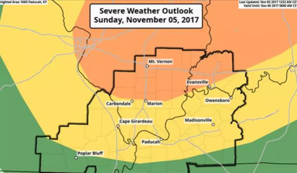
The National Weather Service has placed parts of the WBKR listening area under a SLIGHT risk of severe weather this evening. Areas north of the Ohio River are facing an ENHANCED risk.
Last night, the National Weather Service office in Paducah, tweeted this . . .

According to the NWS' Hazardous Weather Outlook:
Storms near a cold front will move southeast into our region around 5 PM. These storms may initially be scattered, but should develop into a line as they move through the region. There are some indications that isolated to scattered storms may develop ahead of the front in the early evening. Individual storms will be capable of large hail, damaging winds and a few tornadoes. As the storms congeal into one or more line segments, damaging winds will become the primary concern. Torrential rainfall and lightning can also be expected. Ahead of the front south southwest winds may gust up to 30 mph through the day. If we get more sunshine than expected, gusts to 40 mph will be possible.
Of course, stay tuned to WBKR and WBKR.com. We'll keep you posted on further developments. And, if severe weather arises, we'll join our friends at Eyewitness News for complete severe weather coverage.
More From WBKR-FM