Severe Weather to Hit Western Kentucky UPDATE
Western Kentucky has been given a Torcon value of 4, which is a moderate chance of a tornado within 50 miles of your location. A Torcon value of 4 also means that hail and high wind gusts are possible.
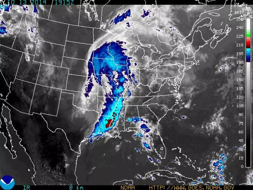
The National Weather Service has issued a 100% chance of rain and thunderstorms for Western Kentucky. Some of us could be experiencing up to three inches of rain. The system is moving across the plains, and should be interrupting Columbus Day with severe thunderstorms and rain in the evening hours.
Missouri is basically cooked right now with rain. We can be expecting the weather to get here and begin letting go around 6pm central this evening. 2-3 inches of rain is expected for Western Kentucky and some other parts of the Tristate. Stay tuned for more updates.
FROM THE NATIONAL WEATHER SERVICE
THIS HAZARDOUS WEATHER OUTLOOK IS FOR PORTIONS OF SOUTHERN
ILLINOIS...SOUTHWEST INDIANA...WESTERN KENTUCKY AND SOUTHEAST
MISSOURI.
.DAY ONE...THIS AFTERNOON AND TONIGHT
A VIGOROUS LINE OF STORMS WILL MOVE EAST ACROSS THE REGION THIS
AFTERNOON AND EVENING REACHING SOUTHWEST INDIANA SOUTHWARD TO THE
SOUTHERN PENNYRILE BETWEEN 6 AND 9 PM. OTHER STORMS MAY DEVELOP
AHEAD OF THIS LINE AS WELL.
SEVERE THUNDERSTORMS ARE A STRONG POSSIBILITY THROUGH THIS EVENING.
THE MAIN CONCERNS WILL BE DAMAGING WINDS AND TORNADOES WITHIN THE
MAIN LINE OF STORMS. LARGE HAIL WILL BE POSSIBLE BUT MAINLY WITH
THUNDERSTORMS THAT DEVELOP AHEAD OF THE LINE.
LOCALLY HEAVY RAINFALL CAN BE EXPECTED WITH ANY THUNDERSTORMS
...HOWEVER WIDESPREAD HEAVY RAIN IS LIKELY WITH THE LINE OF
STORMS THROUGH TONIGHT. TOTAL RAINFALL THROUGH TONIGHT WILL
GENERALLY RANGE FROM ONE AND A HALF TO 3 INCHES. THE GREATEST
AMOUNTS ARE LIKELY ACROSS SOUTHWEST INDIANA AND THE LAKES AND
PENNYRILE REGIONS OF WEST KENTUCKY. SOME LOCALIZED FLOODING ISSUES
WILL BE POSSIBLE...BUT WIDESPREAD SIGNIFICANT PROBLEMS ARE NOT
ANTICIPATED AT THIS TIME.
.DAYS TWO THROUGH SEVEN...TUESDAY THROUGH SUNDAY
THE BAND OF THUNDERSTORMS WITH HEAVY RAINFALL MAY LINGER INTO THE
EARLY MORNING HOURS TUESDAY OVER SOUTHWEST INDIANA AND THE PENNYRILE
REGION OF WEST KENTUCKY. A FEW MINOR FLOOD PROBLEMS CANNOT BE
RULED OUT.
.SPOTTER INFORMATION STATEMENT...
SPOTTER ACTIVATION IS NEEDED THROUGH AT LEAST EARLY EVENING
ACROSS MOST OF THE REGION, AND LIKELY THEREAFTER OVER SOUTHWEST
INDIANA SOUTHWARD TOWARD THE PENNYRILE REGION OF WESTERN KENTUCKY.
SEVERE STORM CHANCES WILL DECREASE FROM WEST TO EAST THROUGH
TONIGHT.
More From WBKR-FM


